
3D World Map: Ranking Every Country by Land and People
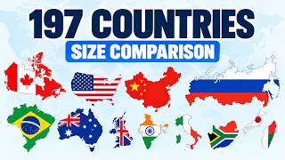
Compare countries by area size through 3D visualizations. See how land mass and population density rank across the globe. This video presents a series of 3D models for various nations, highlighting their physical scale and demographic data. By mapping country size alongside population counts, we provide a clear perspective on how different territories compare on a global scale. The visualizations feature specific details for countries like Nepal, Tanzania, Indonesia, and Madagascar. Each entry displays a flag and a population density breakdown, offering a visual summary of global geography for those tracking international statistics. Subscribe to @ScaleSphere-admin for more comparisons, data and visualizations. Chapters: 0:00 Intro 0:02 Nauru (#194) 1:17 Brunei (#164) 2:41 Guinea-Bissau (#134) 4:19 Bulgaria (#104) 6:18 New Zealand (#74) 8:43 Central African Republic (#44) 11:38 Indonesia (#14) 13:05 Russia (#1) 13:07 The 12 largest countries side by side SOURCES AND NOTES - Surface area and population (2025): World Bank (indicators AG.SRF.TOTL.K2 and SP.POP.TOTL). Surface area includes inland water. Bosnia and Herzegovina and Nicaragua: UN Statistics Division; Kosovo: CIA World Factbook (not in the World Bank area series). - Country borders: Natural Earth (public domain). Shapes show the main landmass; distant overseas territories and remote islands are left out, but the numbers are the official totals. - Satellite imagery: NASA Earth Observatory, Blue Marble Next Generation (July 2004, with topography and bathymetry, 500 m). - Flags: Wikimedia Commons. - Floor texture: ambientCG (CC0). - Music: original, by Scale Sphere. - Only sovereign countries are included; Taiwan and Vatican City are not in the World Bank data set used here. - Figures are rounded to the nearest 100,000 people, so very small countries show a single figure.
Suggested videos

Value Scale & Sphere Shading Exercise | Learn How To Shade
That Art Teacher · 12:17
Largest Countries by Land Area | First Person View | 120+ Countries
WorldTV Studio · 17:00

HOW TO SHADE A SPHERE AND VALUE SCALE: Easy Drawing Tutorials for Beginners Step by Step
J Lowe Artist · 22:47

Countries Scaled by Population 2025 | if countries population where Humans | First Person View
WorldTV Studio · 17:54
Shading a Sphere in Reverse - White on Black
theartproject · 11:24
Countries Scaled by Population: A Unique Perspective on World Populations
Zoom Life · 8:34

How to Draw a 3D Sphere: Shading for Beginners
Circle Line Art School · 4:00
History of the World: Every Year (3400 BCE – 2026)
AtlasNumbers · 17:01

Scale a Sphere - Interactive 3D Graphics
Udacity · 0:35

Every Country in the World by Population | 3D Comparison
Magnify · 8:25

Shading, No-outlines Sphere and Value Scale - theartproject - March 10, 2020 chad brown
theartproject · 12:54
All 197 Countries Size Comparison | Smallest to Largest
Geograck · 26:59