
What Satellites Found on North Sentinel Island That No One Is Allowed to Enter
Satellites have been photographing North Sentinel Island for four decades — and the images show footpaths, vanishing camps, and a 16,000-ton cargo ship that keeps shrinking year after year, because the people below are stripping it into arrowheads. This is everything orbital cameras have ever revealed about the most isolated tribe on Earth, and the one question no resolution can answer. IN THIS VIDEO: Why Google Earth shows the island blurry — and why it has nothing to do with censorship The MV Primrose wreck (1981): four decades of satellite frames showing it being dismantled piece by piece The 2004 tsunami images from NASA's ASTER: how the entire island was lifted an estimated 1–2 meters overnight The census that counted 39 people — and why nobody believes it New clearings spotted in 2025 imagery, and what they suggest about the population If their story matters to you — subscribe. There is another island coming.
Suggested videos

Welcome to Walter Finds the Last Islands! About This Channel
Walter Finds the Last Islands · 1:07
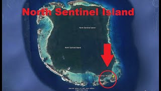
Google Earth Confirms Development on North Sentinel Island - Buildings and Trails Located - Oct 2024
Wherewithal · 6:18

North Sentinel Island: The Island Where No One Is Allowed to Go
Secret Earth · 6:50

241 - From Crete to Malta - Part 1 - Walter Veith
Amazing Discoveries · 1:17:05

The 24,000-Year-Old Tribe That Kills All Outsiders: The North Sentinel
Beyond Known History · 7:38

Walter White visits Elliott and Gretchen Schwartz I in HD I Felina I (S5E16) Breaking Bad
Movie Highlights · 3:53

North Sentinel Island 2026: The World's Most Isolated Tribe Seen from Space
GEODENSITY · 5:52

I've Got a Brand New Land to Find Song | Exceptional Explorers | Horrible Histories
Horrible Histories · 4:02

What's Hidden on the Forbidden North Sentinel Island?
Ridddle · 10:03
walter white in treasure island
Impurity Mouse · 1:01

North Sentinel Island: The Truth Behind the World's Most Isolated Tribe
Places · 23:57

He Stopped Daydreaming and Started Living | Walter Mitty (2013) Movie Recap
CineSnap · 10:16