
Rain relief from the heat, steamy weather holds
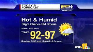
People often talk about humidity, but the dew point is the real number to watch. Anything above 75° is extremely humid, and that’s exactly what we’re dealing with: a lot of water in the air, making it feel muggy. We’ll drop to around 80° tonight, staying warm and humid, with temperatures rebounding quickly into the low 90s by tomorrow afternoon. Winds will shift out of the southwest, pulling more Gulf moisture in. That means dew points could reach the 80s, pushing the heat index to around 112° across inland areas. Heat advisories are in effect again for Wednesday. At the coast, yellow flags are flying, and the Gulf is looking more like a lake, flat and calm. Highs near 92–93°, with only an isolated storm chance. In fact, we’ll see less rain than today, thanks to that southwest flow, which tends to protect the coastline by pushing the sea breeze boundary inland. Earlier storms developed along that sea breeze and were carried southwest by mid-level high pressure. That high is shifting west, so isolated to scattered storms will be possible again tomorrow and into Thursday, with 30–40% coverage both days. The humidity will remain high, so heat indices will likely stay in advisory range through the end of the week. Tropics: The Eastern and Central Pacific are very active, with two storms out there now and three more likely forming soon. The Atlantic, meanwhile, is quiet. We’re watching two yellow-circled areas, but no immediate concerns. However, by August 4–5, we’ll watch the subtropics for possible development. And by August 12, the Main Development Region of the Atlantic should start to wake up. That’s right on schedule — 90% of tropical activity typically occurs between August 20 and October 20. We’re not there yet — but we’re getting close.
Suggested videos

Welcoming Meteorologist Ross Whitley to CBS 17
CBS 17 · 0:59

Steamy heat takes hold
Arirang News · 2:02

Heat through The Weekend, Wet Weather Next Week with Tropical Moisture
Ross Whitley · 3:14
Heat and humidity holding tough
WMAR-2 News · 1:24
Ross Whitley Reel
Ross Whitley · 8:08

Metro Detroit weather: Heat relief for now, but holiday heat returns, July 2, 2021, noon update
Click On Detroit | Local 4 | WDIV · 1:24
Ross Whitley Hurricane Michael 8 a.m. Tuesday
WMBB News 13 · 4:04
North Carolina Forecast: Tuesday brings hot, dry weather and relief from humidity
WRAL · 2:31

Showers and Storms Coverage Increases Wed - Fri
Ross Whitley · 3:09
Ava: Relief From Heat On Way?
WBAL-TV 11 Baltimore · 1:23

Ross Whitley Reel
Ross Whitley · 14:21

Hot & Humid: E Tennessee & N Georgia Alert as Heat Dome Returning!
North Georgia Majestic Weather · 7:22