
Video unavailable
This video can't be played right now.
Geologists Just Found Out What California’s Mount Shasta Actually Is
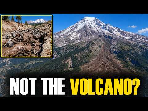
On a September afternoon in 2014, a surge of mud and rock tore down Mount Shasta’s Mud Creek and flooded the roads near McCloud. Nothing had erupted and no earthquake had struck. A new study published in November 2026 has now counted 162 of these debris flows coming off California’s tallest volcano, with no eruption behind any of them, and many arrived on hot, cloudless summer days with no rain at all. In their paper, USGS-affiliated scientists call them the most prevalent hazard of the volcano’s current quiet period. This video follows the evidence from a 1905 newspaper and the mud-choked summer of 1924 to modern seismometers that hear debris flows grinding down the mountain. It explains how melting glaciers turn into rivers of mud, why a century-old local theory turned out to be right, and what an ancient collapse in Shasta Valley reveals about what Mount Shasta actually is. Video Timestamps: 0:00: The Mudflow With No Eruption 1:22: The Volcano Everyone Knows 2:48: The Summer of 1924 3:45: How Seismometers Hear Mud 5:00: What Turns a Glacier Into Mud? 7:39: The Locals Were Right 9:05: What Mount Shasta Is Turning Into Scientific and Historical Insights: - New Record: A 2026 study in the Journal of Applied Volcanology documented 162 debris flow episodes at Mount Shasta, 55 of them detected by seismic monitoring between 2020 and 2025. - Flows Without Rain: Many flows struck between June and September on days of 30 to 40 °C at the mountain’s base, and researchers interpret them as glacial meltwater events. - Snow Matters: Melt-driven flows were more common after low-snow winters and were more than twice as frequent in drought years before 2000. - Old Knowledge: Newspapers from 1905 and 1924 already blamed thin snow and sudden thaws, and the 2026 paper says this local knowledge is “substantiated by modern quantitative observations.” - Shrinking Ice: Shasta’s glacier volume fell about 22 percent between 1986 and 2022, exposing steeper gullies and more loose sediment. - Ancient Collapse: Hundreds of hills in Shasta Valley are pieces of an ancestral Mount Shasta that collapsed 300,000 to 380,000 years ago, with no evidence of an eruption. - Quiet Volcano: Magma last reached Shasta’s surface about 3,200 years ago, and the USGS expects weeks to months of warning signs before any future eruption.
Suggested videos

This Groundhog Hole in Pennsylvania Could Rewrite Human History
Genefall · 7:18

Geology of Mount Shasta (California, USA)
Geology with Solomon · 17:10

This Creek Bank in Texas Hides Tools That Match Nothing on Earth
Genefall · 9:11
The Most Paranormal Place On Earth - What's Happening on Mount Shasta?
The Why Files · 21:06

Something About Canada’s Viking Site No Longer Makes Sense
Genefall · 8:46
Geologists Issue RED ALERT After Mount Shasta Linked to Cascadia Fault by Hidden Magma System!
Discoverable · 20:49

Did a Genetic Disaster Almost Wipe Out Ancient Humans? | GENEFALL
The Angry Ancestor · 20:50
Something Is Wrong With Mount Shasta — And It’s Not Just The Volcano
Geographic Horizons · 15:26
MOUNT SHASTA: The Volcano That Could Cut California in Half
Vanished Worlds · 50:18

This Sand Mine in Virginia Could Rewrite The First American Story
Genefall · 7:38
Mount Shasta COLLAPSING — Scientists Say Mount Shasta Could Fail In Any Direction
GeoSphere · 15:30
Something About Yosemite’s Half Dome No Longer Makes Sense
Genefall · 15:42